Intro: The D15 running from Nantillois to Cunel is perhaps one of the most travelled roads by American battlefield visitors. Going back to 1938, the ABMC described the route as follows:
“From here [Cunel] to the next town, Nantillois, the tour goes opposite the direction of the American advance. The view of the terrain is, therefore, that which was seen from the various German positions.
The difficult character of the ground over which the American Army forced its way forward is illustrated by the country between here and the next village, Nantillois; and the bitter nature of the fighting is indicated by the comparatively small yet numerous American gains made along this road. In the next 2 1/2 miles there are six pronounced ridges which run almost at right angles to this road. It took the First Army 14 days of nearly continuous fighting to capture them. Each time the Germans lost a ridge they had one equally good for defensive purposes just behind it.” (American Armies and Battlefields in Europe, 1938 version, page 255.)
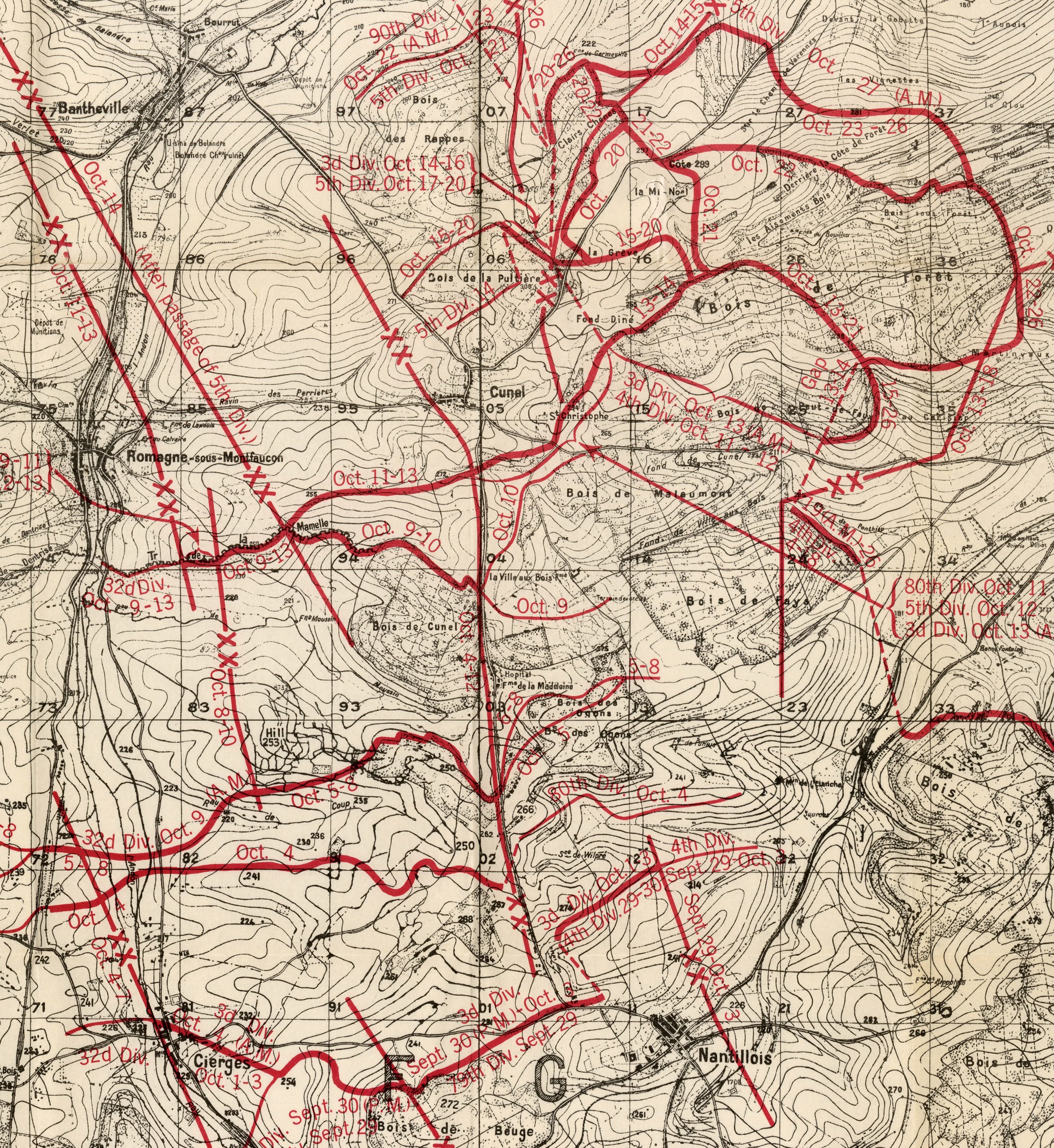
The road itself formed the divisional boundary between the 3rd Division to the west and the 80th Division to the east.
It is hoped that the “then” photos, taken in early 1919, will give readers a better feel for the vicious fighting that occurred here and for the German instillations in the area, approximately 10 – 15 kilometers (6 – 10 miles) behind the front line of 26 September, 1918.
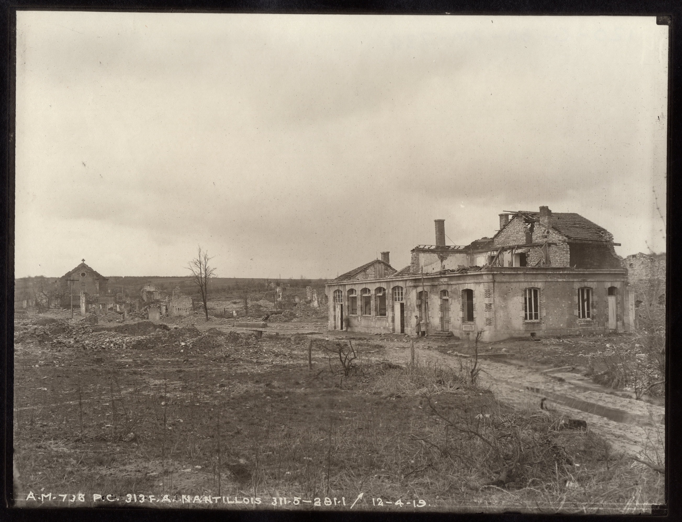
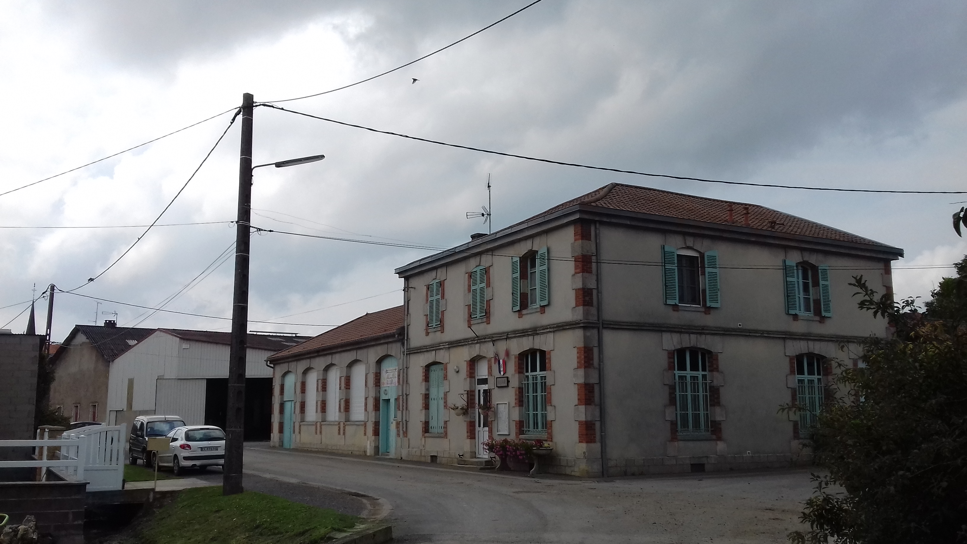
Caption: Griffin Group photo A.M. 738. P.C. 313 Field Artillery, Nantillois. 311.5 – 281.1. Taken on 12 April, 1919. This is Nantillois’ Mairie. The church steeple is just visible in the “now” photo.
Location: The Rue du Ruisseau on the eastern edge of town.
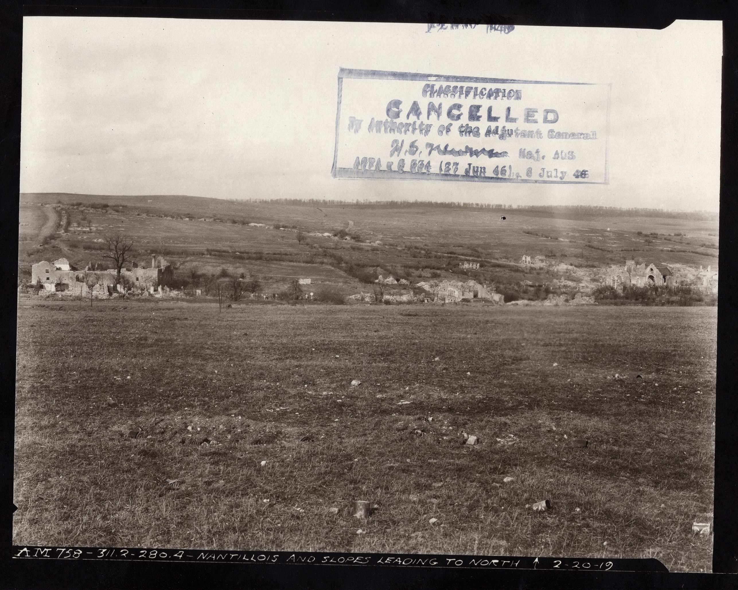
Caption: Griffin Group photo A.M. 758. Nantillois and slopes leading to north. 311.2 – 280.4. Taken on 20 February, 1919.
Location: Taken from the D15 south of town; a bit south of the “Y” intersection.
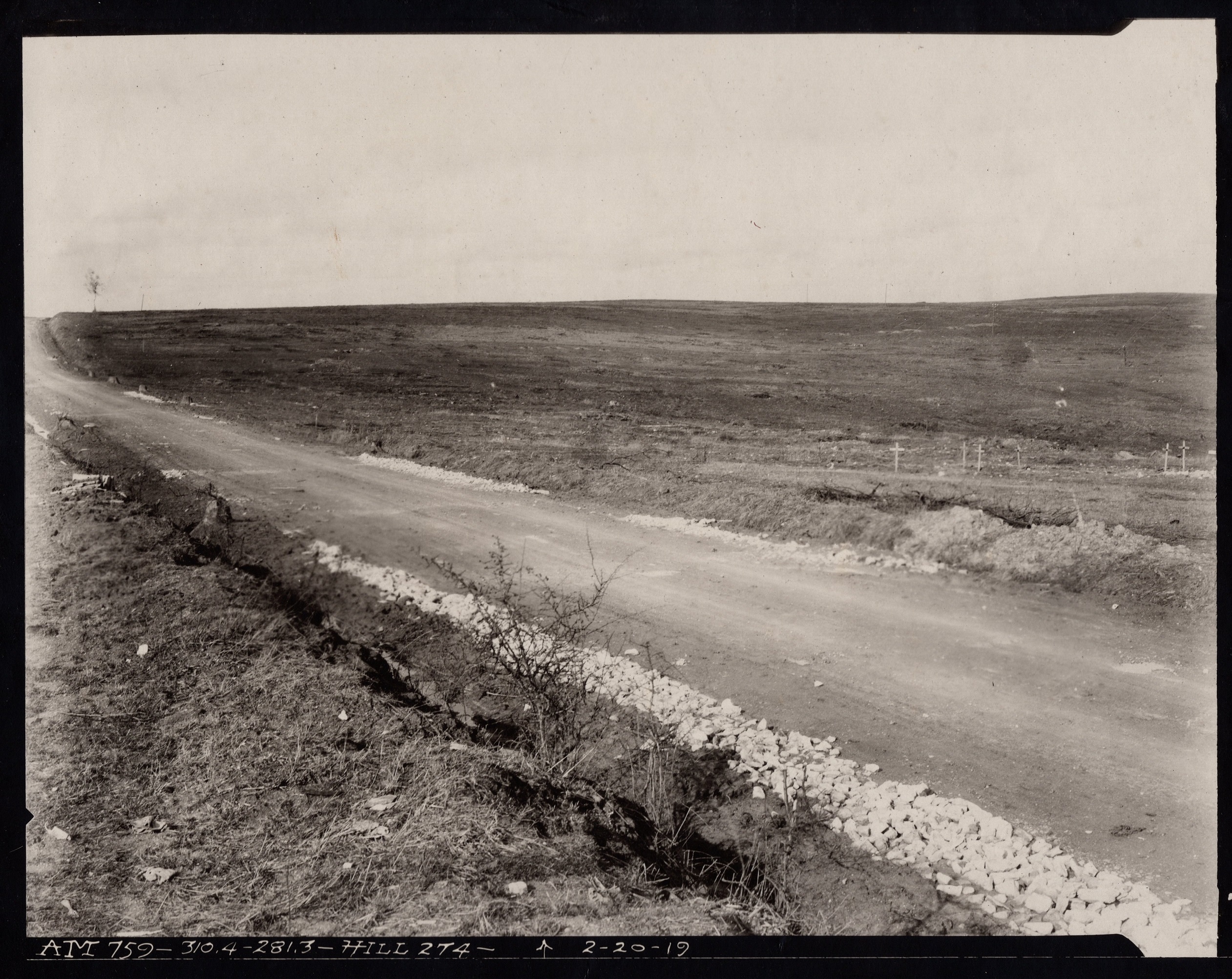

Caption: Griffin Group photo A.M. 752. Hill 274. 310.4 – 281.3. Taken on 20 February, 1919. Note the American crosses in the field on the “then” photo.
Location: On the D15 north of Nantillois. On today’s IGN map it is marked Bne 274.
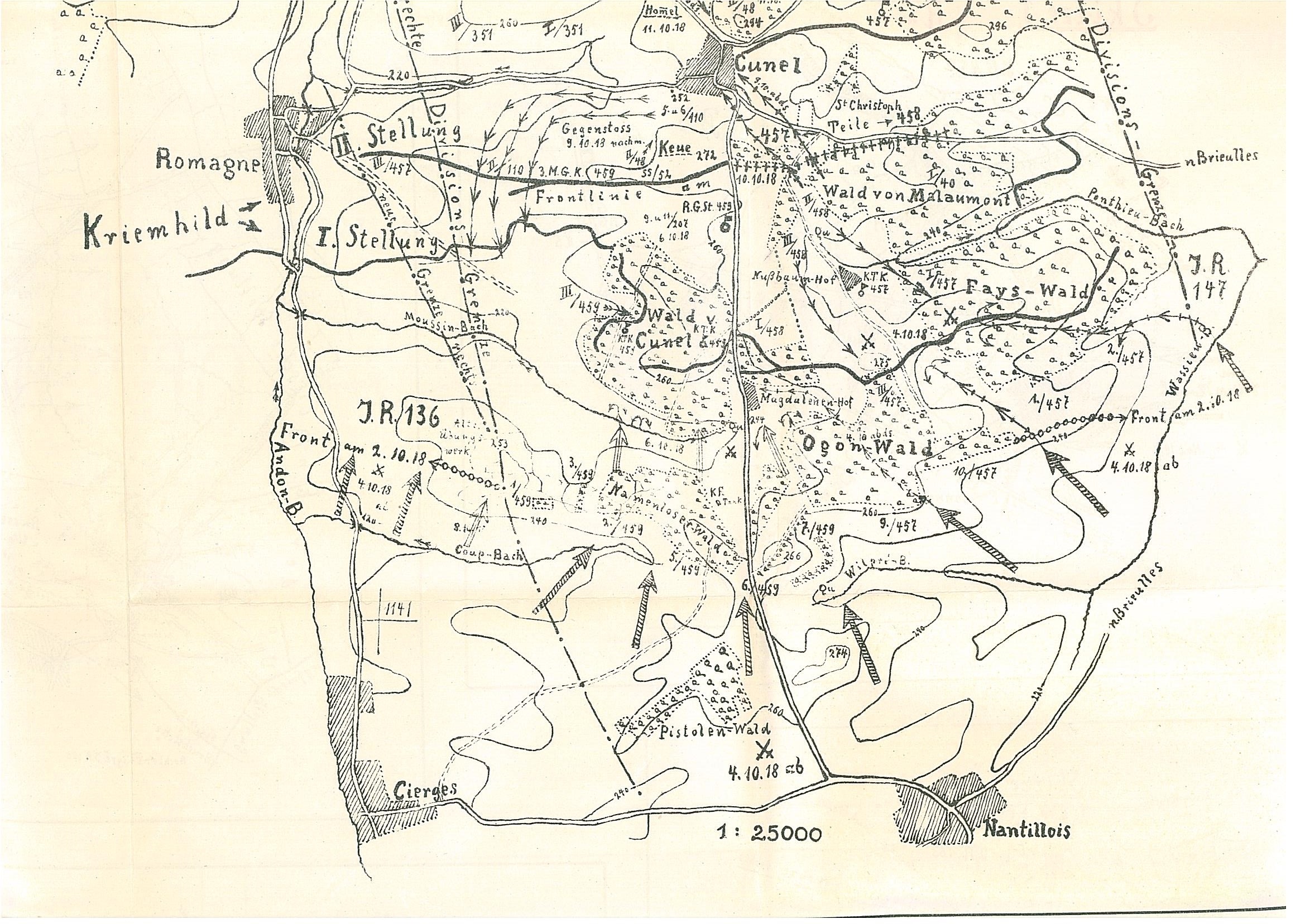
Caption: Map from regimental history of Infanterie-Regiment Nr. 459 showing the position of the Kriemhildestellung (aka Hindenburg Line) near Romagne and Cunel.
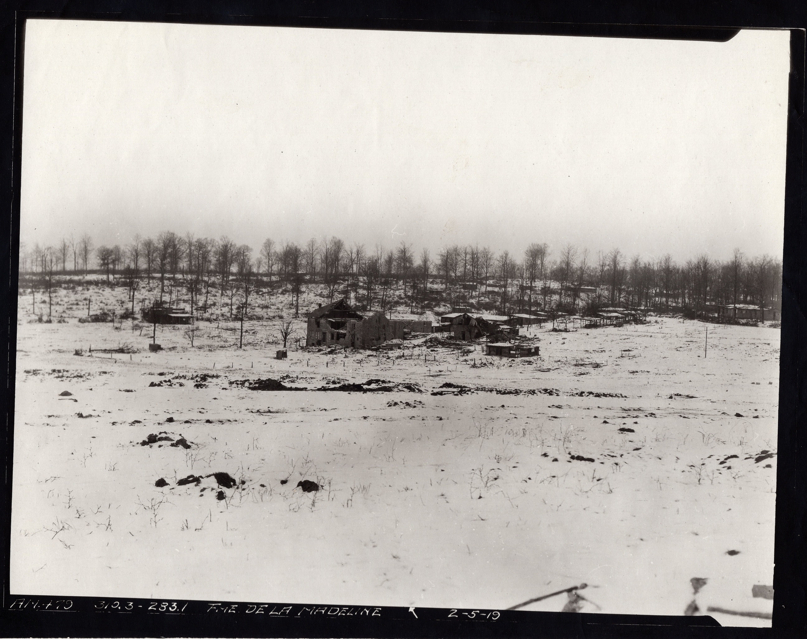
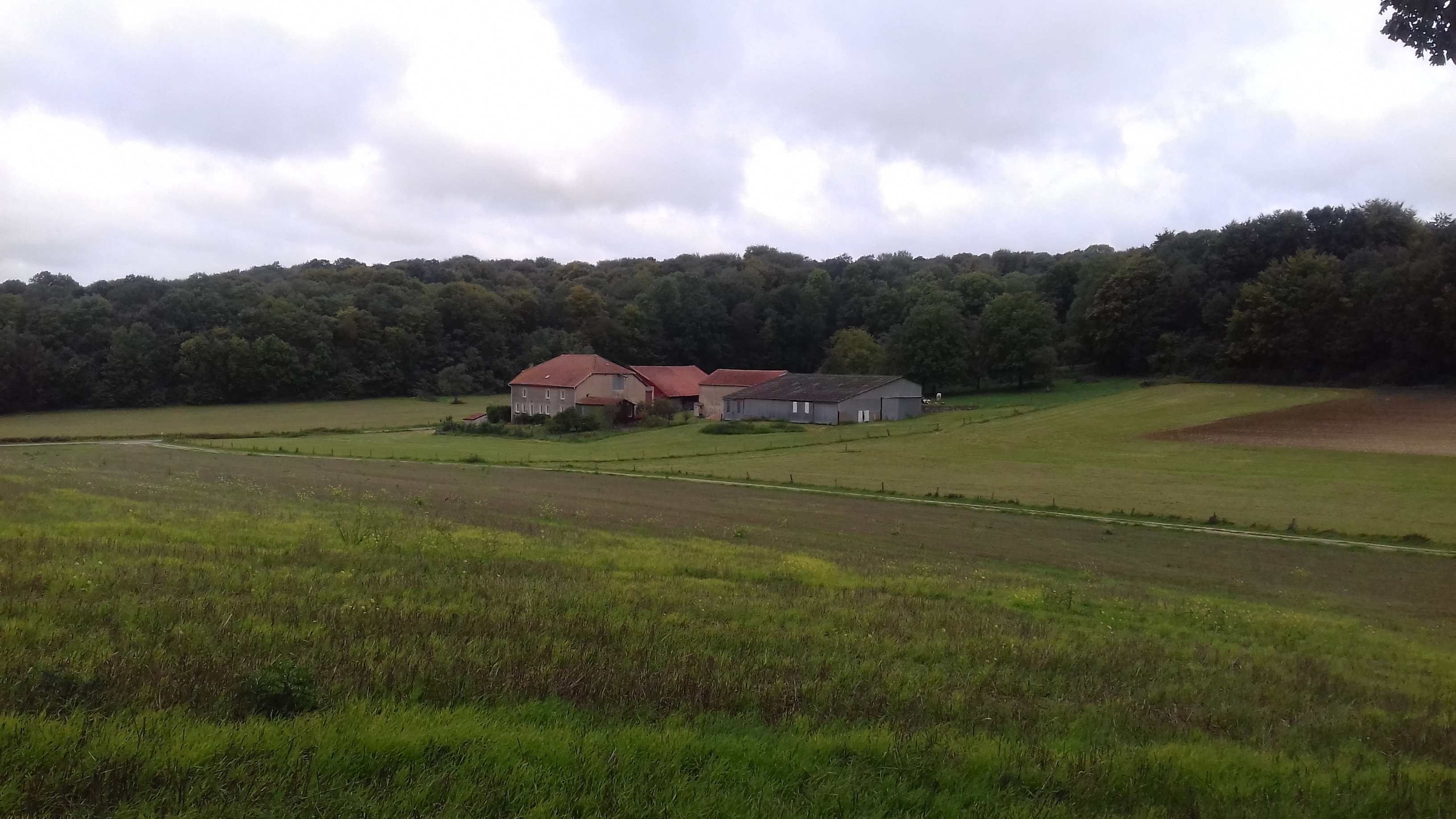
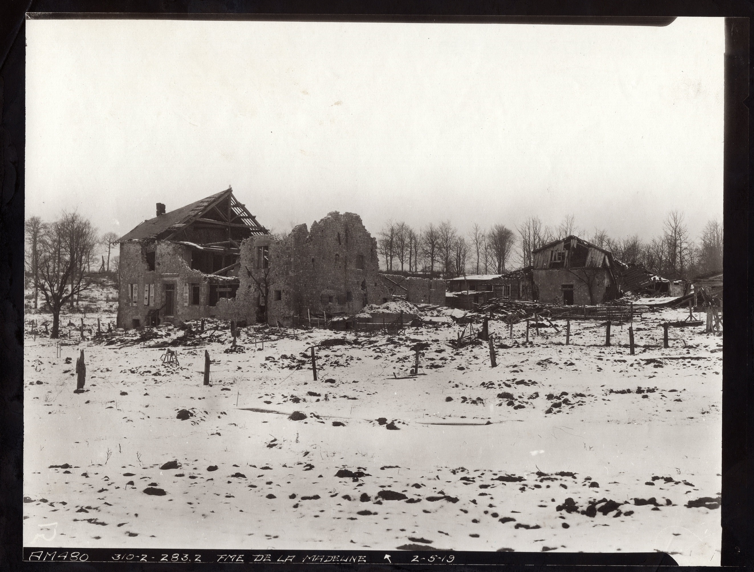
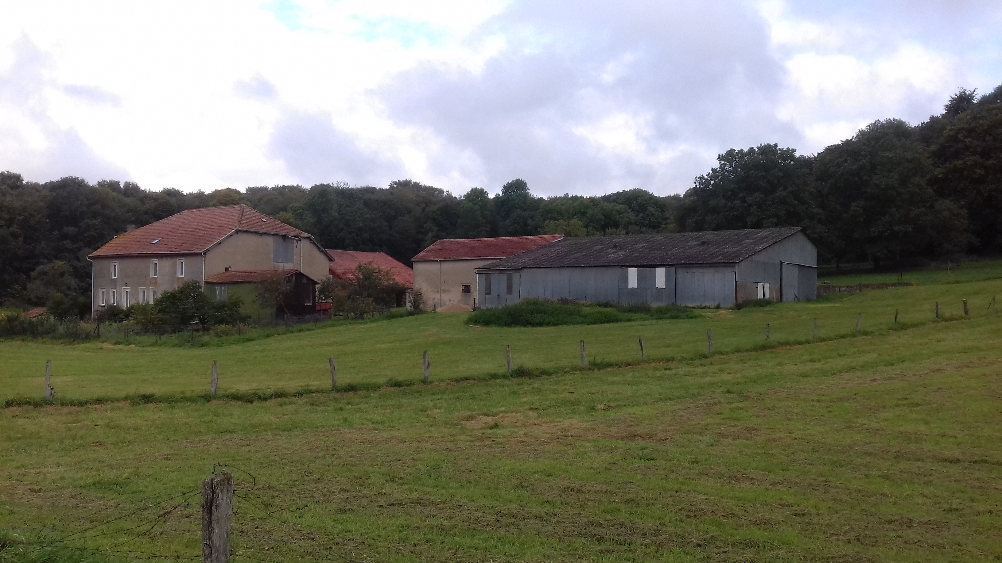
Caption: Griffin Group photos A.M. 479 and 480. Fme de la Madeline. 310.3 – 283.1 and 310.2 – 283.2. Both taken on 5 February, 1919. The farm served as a German hospital, and the (resulting) Deutscher Soldatenfriedhof Nantillois is located about 150 meters to the east. After the Americans advanced, the farm served as P.C. for various American units.
Location: On the D15 between Nantillois and Cunel. The distant photo was taken from the Northwest corner of the Bois des Ogons. The close-up photo was taken from the same angle, but closer to the road to the German cemetery.


Caption: Griffin Group photo A.M. 751. Destruction along Nantillois – Cunel Road. Bois de Cunel. 310.1 – 283.4. This gives a good idea of the German infrastructure around Madeleine Farm. It appears that the photographer was standing on top of a building a bit further off the road in the “then” photo.
Location: On the D15 just behind Madeleine Farm, looking north; where the woods on the east side of the road are quite thin.
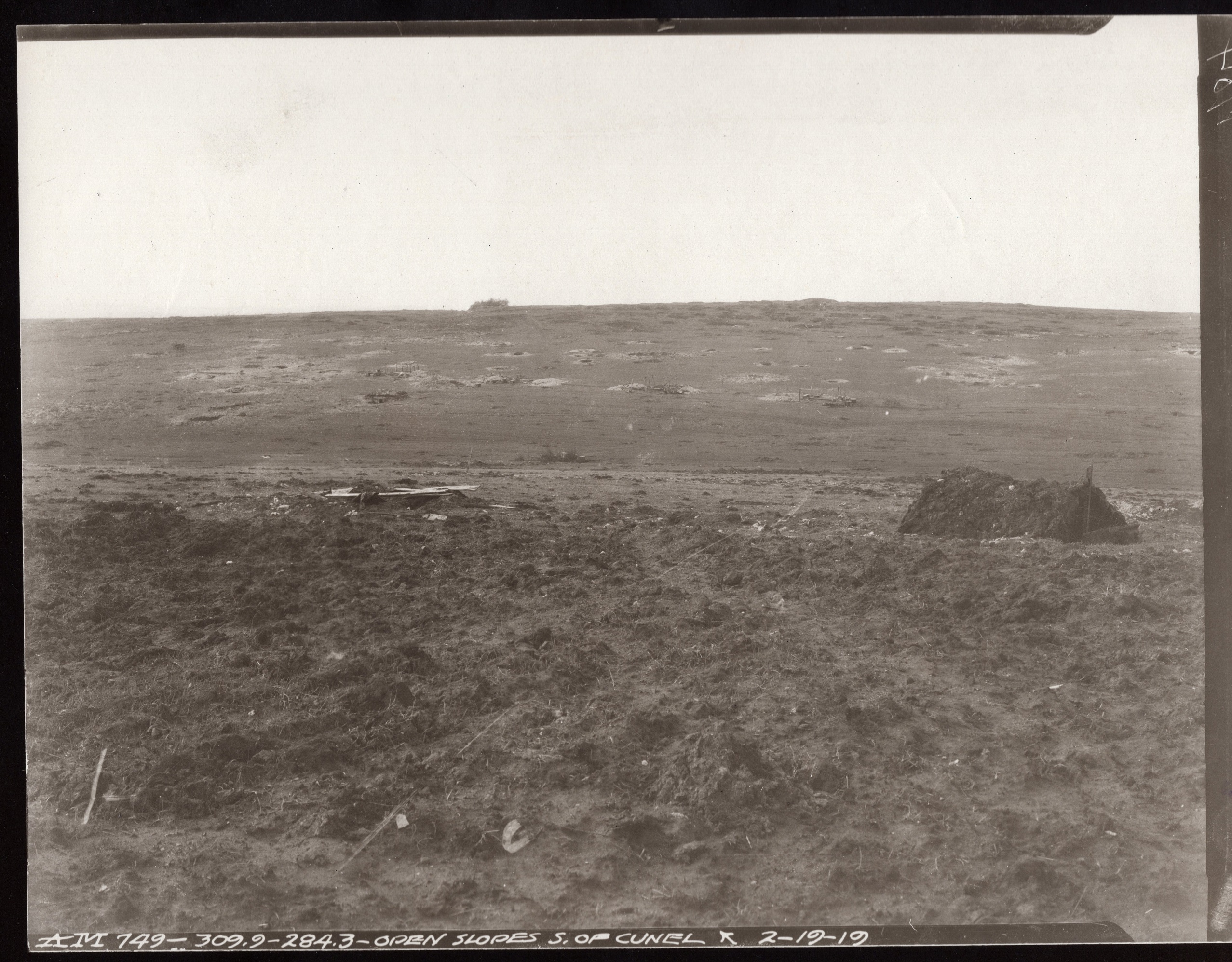
Caption: Griffin Group photo A.M. 749. Open slopes south of Cunel. 309.9 – 284.3. Taken on 19 February, 1919.
Location: This photo was taken about where the Tranche de la Mamelle ended at the Bois de Cunel. To get to that location, the Webmaster drove the narrow farm lanes marked on today’s IGN map.

Caption: Griffin Group photo A.M. 747. Cunel. 310.0 – 284.5. Taken on 19 February, 1919.
Location: This photo was taken from the farm lane just west of the D15 and south of Cunel looking north.
Source of Then Photos: National Archives, Griffin Group Photos, RG 120G
Source of Now Photos: The Webmaster

