“The taking of Apremont was the greatest struggle the division had in its fighting career. Much has been said and written during the war of “the blood-soaked fields of France” and “streams of blood.” Officers who were at Apremont solemnly vouch for the fact that there was a time in that town when the water running in the gutters was bright red with blood.
And not all of it was German blood.”
Thus begins a chapter in “The Iron Division: The National Guard of Pennsylvania in the World War” by H.G. Proctor. (The John C. Winston Company, Philadelphia, 1919) While the author uses the colorful language of the post-war period, the Webmaster remains unconvinced that Apremont was the division’s greatest struggle: The 28th Division also had suffered heavy casualties astride the Vesle River and when fighting to get atop the plateau known as Le Chene Tondu. (English: The Shorn Oak.) But today it is true that most tourists pass through this quaint, peaceful town adjacent to the Argonne Forest without giving much thought to the fighting that occurred there in late September, 1918. In fact, many of the tourists stay and/or eat at L’Argonn’ Auberge on the main road through town. Therefore, it is fitting to show Apremont “then and now.”

Caption: Griffin Group Photo AM316. Salvage Dump, Apremont. 300.6 – 278.2. 5 January, 1919. While the trees in the “now” photo block much of the view, the water tower and train station are clearly still present today.
Location: On the D242 just East of the town.
Source of Then Photo: NARA Record Group 120G, “Griffin Group Photos.”
Source of Now Photo: Webmaster


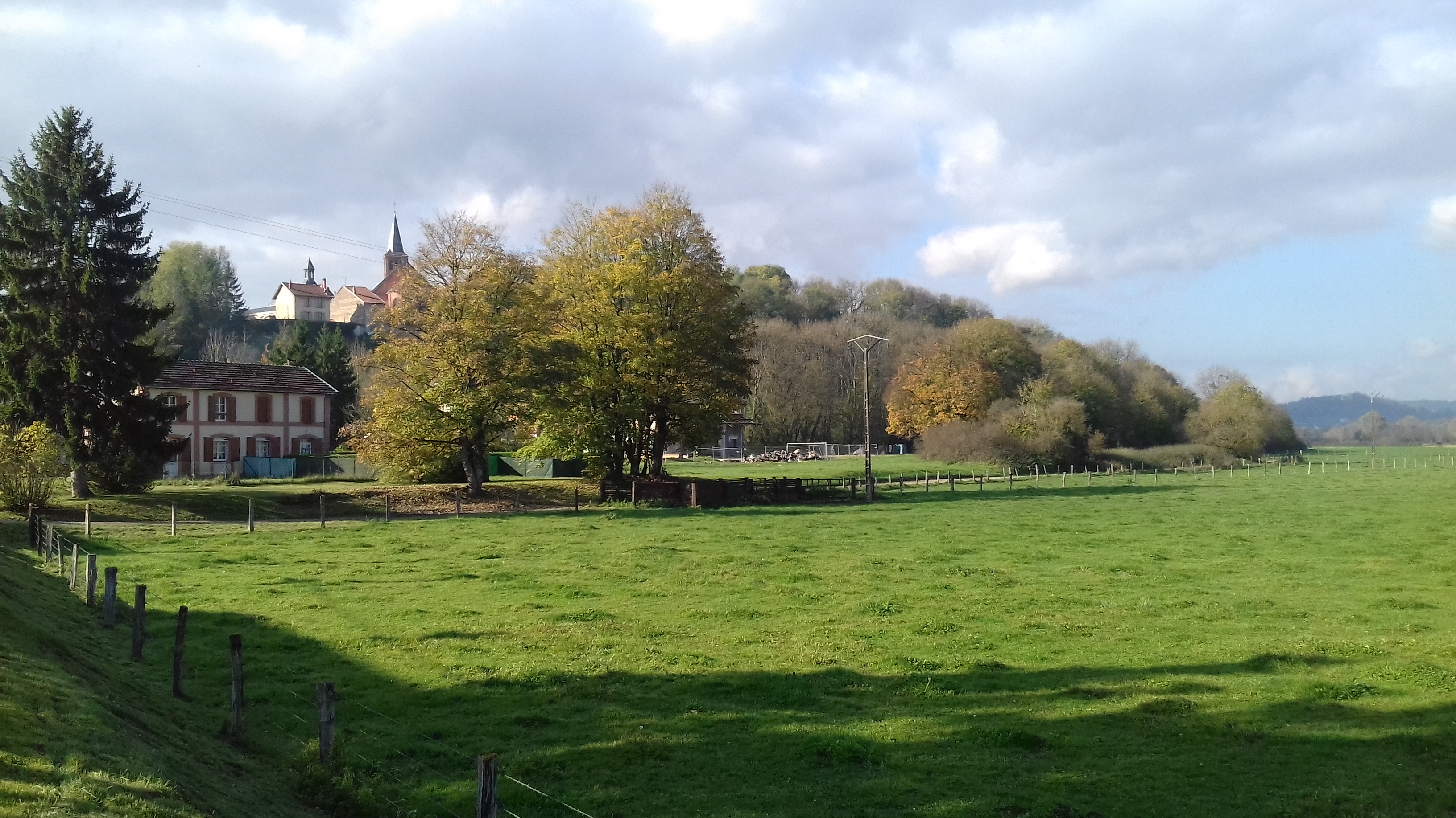
Caption: Griffin Group Photo AM970. Apremont. 300.1 – 278.2. No date. These two photos show the difficulty in lining up “then and now” pictures. It is the angled corner of the retaining walls just below the center building and the walking path down the hill that match up. Note that today’s retaining wall at the street level does NOT continue as far as it did in the “then” photo.
In fact, there is a panoramic shot of 4 photos showing this hillside combed with dugouts. However, it is virtually impossible to get a true “then and now” photo match. Therefore, only one will be shown below.
Location: On the D442, the main road in town and just across from the hotel/restaurant L’Argonn’ Auberge.
Source of Then Photo: NARA Record Group 120G, “Griffin Group Photos.”
Source of Now Photo: Webmaster
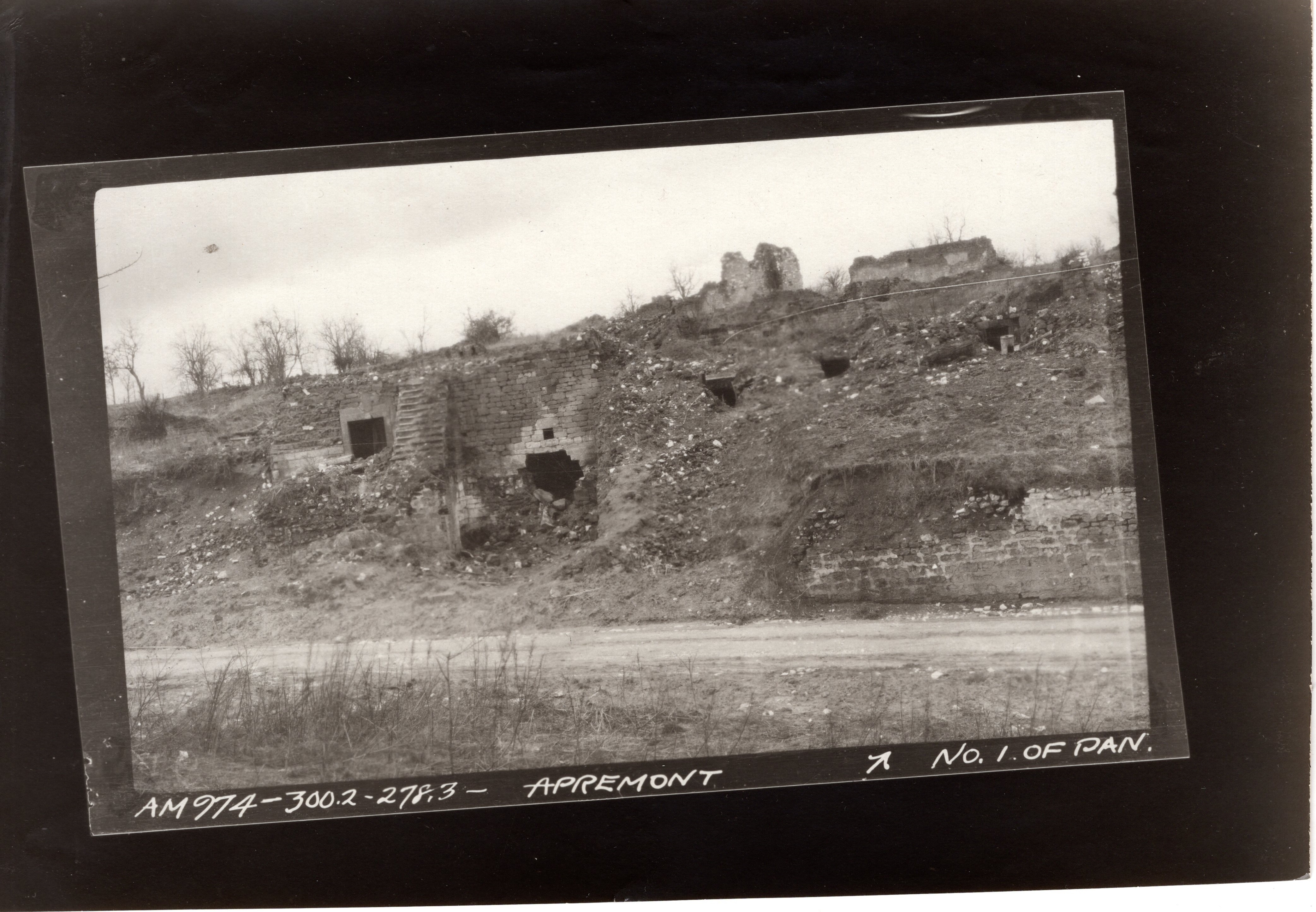
Number 1 of the 4-photo pan showing the hillside in Apremont. It is just too difficult to match up specific parts of the photo.
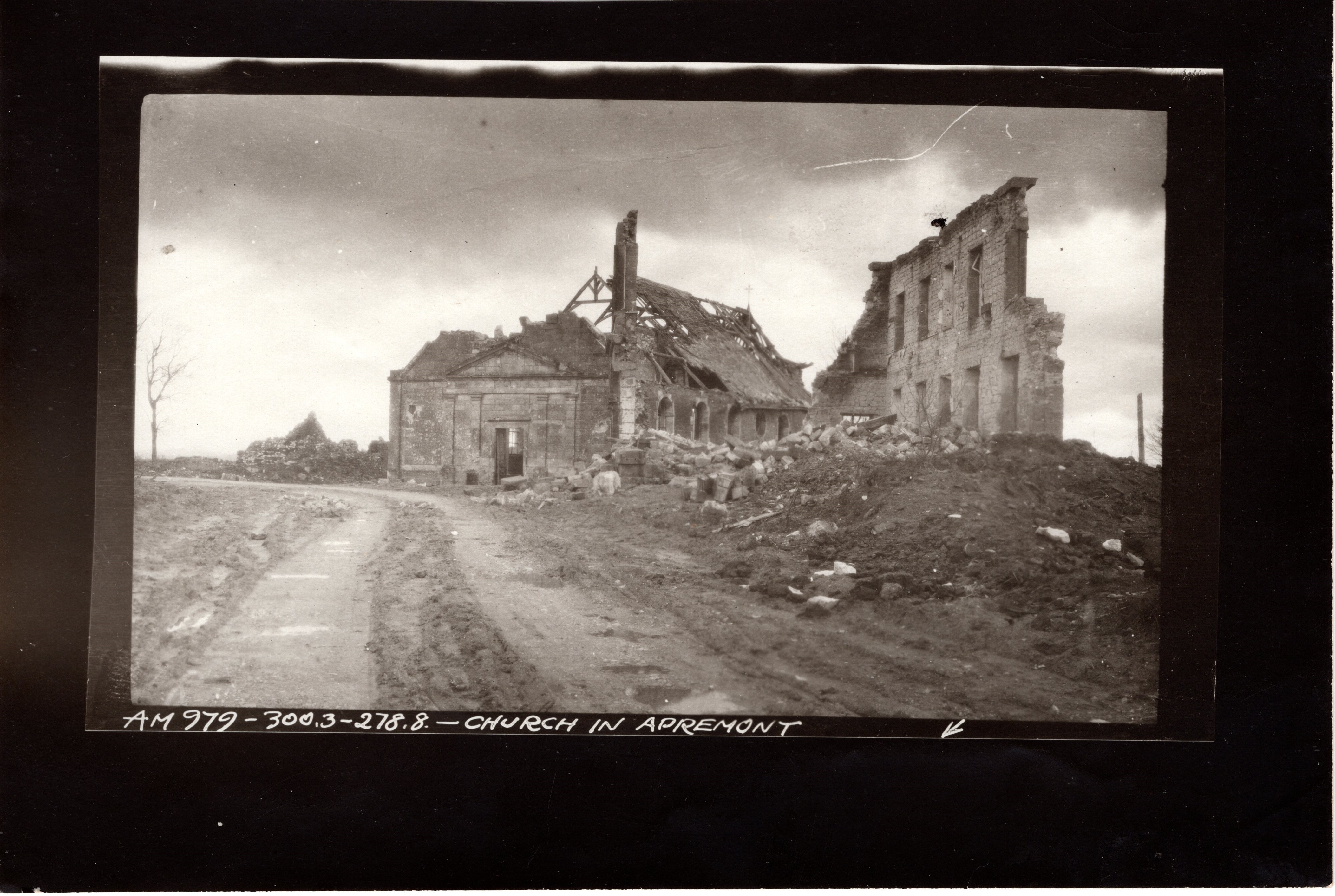
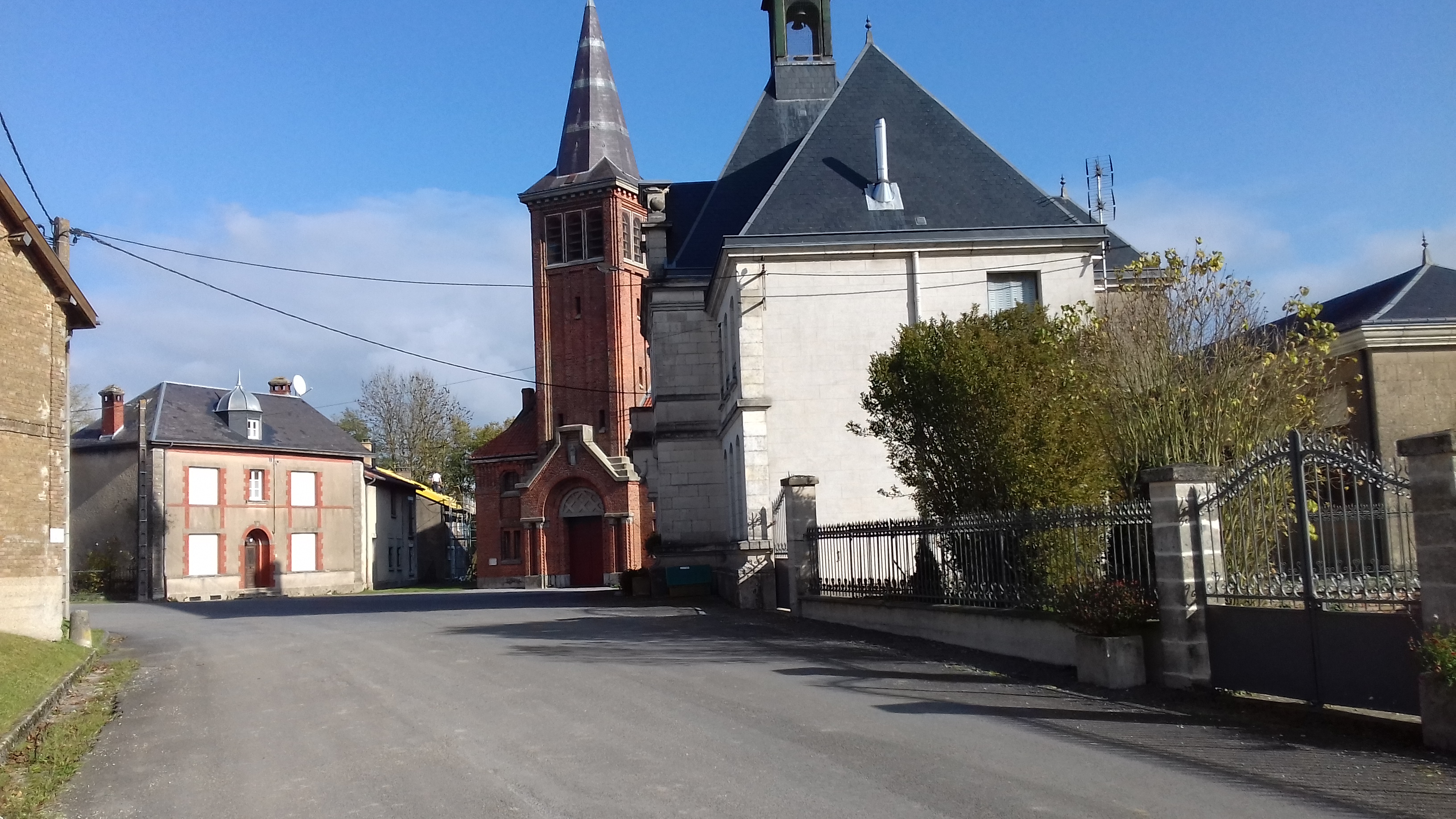

Caption: Griffin Group Photo AM979. Church in Apremont. 300.3 – 278.8. No date. The Webmaster has noticed that churches were often modified when being re-built post-war.
Location: The church is on the D42 in the upper half of the village.
Source of Then Photo: NARA Record Group 120G, “Griffin Group Photos.”
Source of Now Photos: Webmaster

