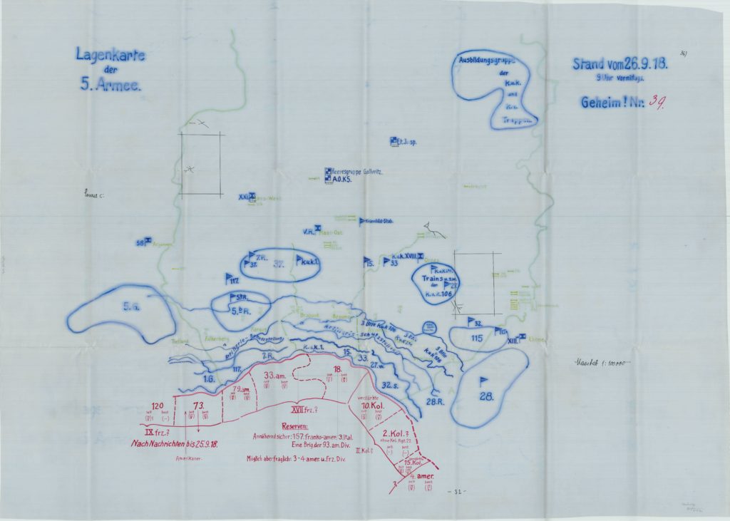
Throughout the 1920s and 1930s the Army War College had representatives at the German Reichsarchiv in Potsdam who were making exact copies of Imperial German military documents so they could be studied and analyzed by the U.S. military. One subset of documents is the tracings of daily situation maps (singular, Lagenkarte) created by the individual German Armies. These situation maps are an important resource for examining the German side of the St. Mihiel and Meuse-Argonne Offensives.
Created at the individual Army-level, the original Lagenkarten (plural) show the disposition of German Army Groups and divisions within the stated German Army; adding to a better understanding of the German forces on the ground and the command structure. To varying degrees, the maps include major defensive lines, aviation units (balloon and aircraft), unit headquarters, units in reserve, major training areas and some railroad lines. They also provide a glimpse of enemy units that the German Army believed it was fighting. (Note: The latter is not always accurate.)
These maps were generally updated and produced daily at the Army-level; making it possible for researchers to analyze the changes in units on an almost daily basis. Unfortunately, NARA’s collection has a few gaps. A complete listing of maps included is provided on the sales page.
The collection also includes 3rd Army maps from 25 – 30 September, as “Group Argonne” was part of the 3rd Army until 5 October 1918. Unfortunately, NARA’s collection does NOT include 3rd Army maps from 1 – 5 October; leaving a gap in coverage during crucial days in the Argonne in early October.
The original 5th Army maps were produced in 1:100,000 scale and the Army Detachment C maps were produced in 1:300,000 scale. Because of this scale, the focus is largely on divisions and higher echelon units.
The U.S. Army tracings (of the originals) were produced on a transparent sheet that is similar to wax paper. Many of the original “wax paper” overlays can still be viewed at the National Archives in College Park, MD. However, most are in very fragile condition. Therefore, at some point, the National Archives created duplicates on white or light blue plastic sheets. The maps in this collection are large scale scans from those duplicates.
Each map in this collection has been scanned at 200dpi and each map is provided in two file formats: .jpg and .tiff. As a result, this collection is about 5GB in size!
Readers interested in this collection should view this page on the website: https://meuse-argonne.com/?page_id=3544. There, they will find a more complete User Guide, a German Order of Battle and a List of Maps Included in this product.
As researchers know, the fun is found in the details. These maps are a treasure trove of information on the Meuse-Argonne and St. Mihiel Offensives–from the German point of view.
Hals und Beinbruch! (Good Luck!)


