Webmaster’s Note: While not concerned specifically with the American Meuse-Argonne Offensive, the following account taken from the “Blue Book” of Section One of the American Field Service describes the route that these volunteer American ambulance drivers took from the poste des brancardier (stretcher-bearer post) at Jubécourt to the poste de secours (aid post) at Esnes, closer to the front in 1917.
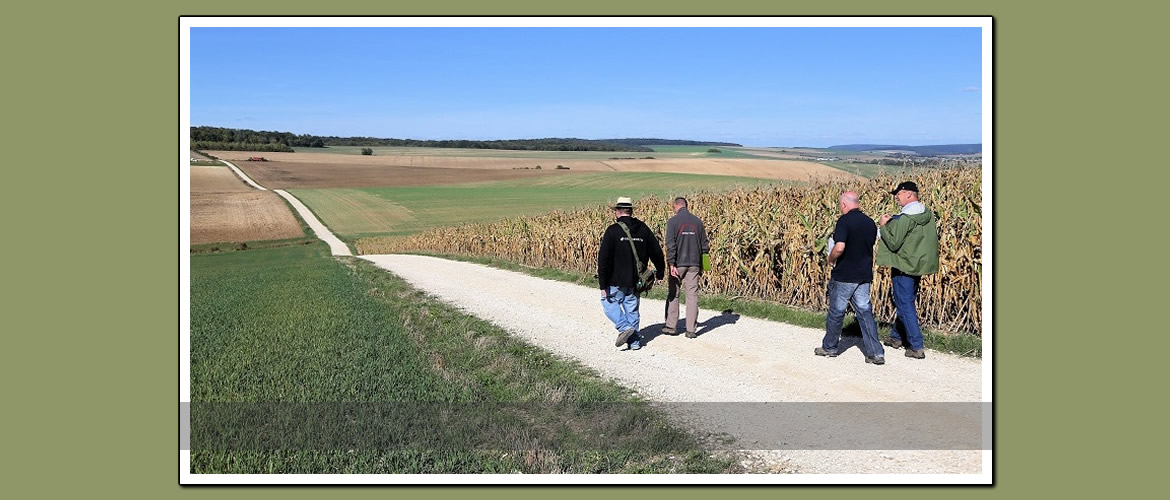
The high level of detail allows this route to be retraced very easily on today’s maps and roads. While the route described is only 22km long, readers might want to allow ample time to read the description and to get out and explore the area.
It is recommended that readers preparing to drive the route obtain IGN maps 2113est and 3112 est. The first will cover the first half of the journey to Dombasle. The second will cover the portion from Dombasle to Esnes. Once in France, these can generally be found in press stores or tobacco stores in local towns and villages.
The webmaster would be interested in learning whether any additional “Blue Book” descriptions exist, and where they might be located. He has not contacted AFS to see if it might exist in their archives.
Reprinted from: History of the American Field Service in France, Volume 1, Houghton Mifflin, 1920. Pages 155-57. (This first appeared in the Webmaster’s original Meuse-Argonne website several years ago.)
The Drive
Leaving the poste des brancardiers (stretcher-bearer post) at Jubécourt, turn right on sharp grade. This is Ringwalt Corner; for it was here that Ringwalt went over the bank on the night that we took over the sector, his car turning over twice. How he managed to get over on the left-hand side of the road and slip over the bank while going up hill on low speed, nobody knows; but he did it.
Continue north over the fairly level route, part of it very rough, to Brocourt (3.5 km.) entering the village over a miserable piece of corduroy road after left turn at cemetery. Bear right, passing to rear of church. Beware of other roads leading to Auzéville, Brabant, and Jouy. Sentry at corner. Pass sign, “Éteignez vos lumières,” descending steep hill, cross small railroad, munitions dépôt, down gulch to the left, large gun to the right. Ascend steep grade and continue along level road, cross old Roman road and pass on the right a génie (engineer) camp situated in a small wood—Bois de Fouchères. Continue over very rough stretch of road to sentry box (6.5 km.) turn sharp to right. Country immediately surrounding the sentry box is quite bare. From this point there is a very good view of Clermont-en-Argonne, due west; and the eastern slope of the Argonne Forest, as far south as the Côte des Cerfs near Brizeaux, is also visible.
Continue along winding road—fine view of Dombasle and country to the northeast, especially the Bois de Béthelainvile—downhill into Dombasle-en-Argonne (11.1 km.) cross Sainte-Ménehould-Verdun railroad, turn left over small bridge and cross Paris-Metz Grand Route (N3) (elevation 235 m.) passing on the right a picturesque ruin with tall chimneys and extensive garden; bear left through the village and continue on gentle upward grade.
Barracks on hillside to left; Béthelainville poste de secours (aid post) in cave on hillside on right. Road from this point is extremely rough. Pass source on right and enter Bois de Béthelainville—ammunition dépôt resembling stone quarry on right. Continue through wood—batteries on both sides of road.
Emerging from the wood (elevation 328 m.) we have good outlook, including view of hills near Chattancourt, le Mort Homme, Hill 310, Hill 304, and vicinity of Montfaucon and other points beyond the German lines. Descending from this point by easy grade along tree-lined road with shell holes on either side, enter Montzéville (17.8 km. Elevation 240m.) The poste de secours is situated in a cave on the left. Along the left or west side of the village lies Hill 310 on which many batteries are planted. Pedestrians may take path across Hill 310 to Esnes—2 km.
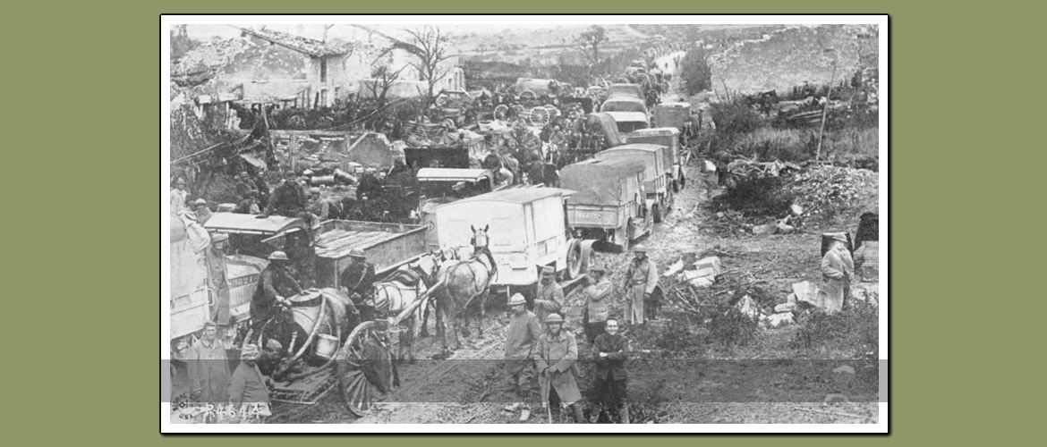
Leaving Montzéville, road bears slightly left and enters the ‘Bad Lands’ road—extremely rough passage over slight rise and stretch of uncrushed stone. In field to left are batteries of soixante-quinznes disguised as pig sties. Road is bordered by stumps. Beware of extremely rocky place, which must be crossed on low speed, and a short distance farther on, another one even worse. Bear left at fork—road to right goes to Chattancourt. Ascend easy grade; road very rough, soixante-quinze batteries to left, camouflage made of branches erected on right side of road. In this vicinity drivers may expect to meet field kitchens and droves of burros at any hour after dark, until 3 A.M.
Pass inverted fork in road where highway from Marre joins at acute angle. Now we are at Toy’s corner. The road from this corner to the next corner—about half a kilometer—is within plain view of the German trenches on le Mort Homme, two kilometers to the north. Begin gentle descent, watch for new shell holes, turn abrupt left (elevation 234m.) probably the most dangerous point on the road, the corner being subject to indiscriminate shelling at all hour, and extremely skiddy in icy weather.
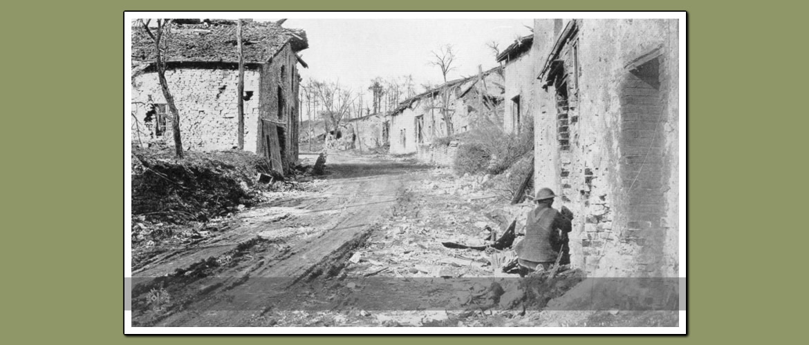
We are now overlooking the village of Esnes. Continue gentle descent, pass wrecked ambulance on right, where is a fine view of Hill 304 about a kilometer to the right, ruins of houses on either side, dead horse on the right, dead donkey and pile of wire and other génie material on the left. At this point the road becomes a perfect morass of mud and ice which can be crossed only on low speed and by the exercise of the utmost caution to avoid crevices, boulders, and sink-holes. Pearl, Tyson, and Hibbard became fast in this hole on the night of January 25-26, and Farlow, Kurtz, Flynn, and Wood on the night of February 16-17. Arriving at corner with tower of ruined church on right (elevation 225m.) cross bad ditch and turn into narrow lane passing to left of the church. Avoid large shell-holes on left side of road and 15 meters farther on, another shell hole on left, opposite stone watering trough on right. Continue 10 metres over rocks to ruined chateau on right (21.8 km.). Turn car in small yard covered with rubbish. End of route.