Introduction: In this selection of Griffin Group then and now one has the opportunity to see areas that were hell for the 77th Division when attacking St. Juvin as well as the German rear-area infrastructure that existed in the Meuse-Argonne.
One of the most vivid accounts of the capture of St. Juvin can be found on pages 342-6 of Ed Lengel’s book, “To Conquer Hell: The Meuse-Argonne, 1918.” He describes: “The 306th’s First Battalion left Marcq at 8:30 A.M., but instead of Marching east as Alexander had specified, it moved north toward the riverbank immediately south of St. Juvin. The mistake had terrible consequences. There was no cover at that point on the riverbank. Worse, there was no way to cross. Instead of withdrawing, the battalion command held his men in full view of the enemy while scouts ran back and forth, desperately trying to find a place to bridge or ford…” Lengel goes on to state that Major Archibald Thathcher, commanding the 2nd Battalion, 306th Inf. Regt. found a place to cross “where the Aire split into two shallow streams,” and, following orders, Thatcher and his men started the advance at 2:00 P.M.
Note that the crossing point described in the Griffin Group photo is NOT the location where the river splits; as seen on the map below. However, in keeping true to the “then” photo, the “now” photo was taken in the same location.
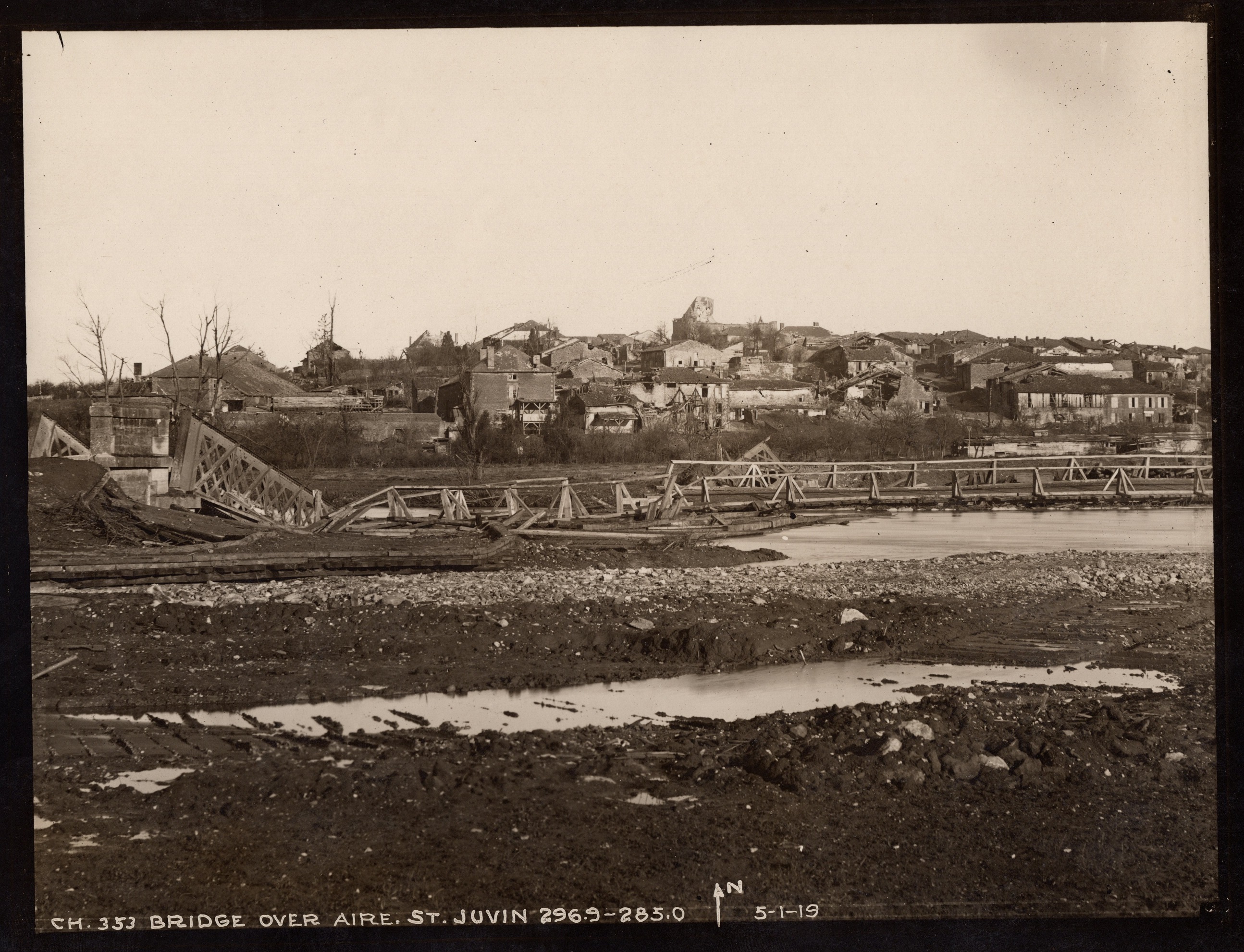

Caption: Griffin Group photo C.H. 353, “Bridge over Aire, St. Juvin 296.9 – 283.0,” taken on 5 January, 1919. Unfortunately, the current growth makes a good then and now line up difficult.
Location: On the D42 at the Aire River, south of St. Juvin
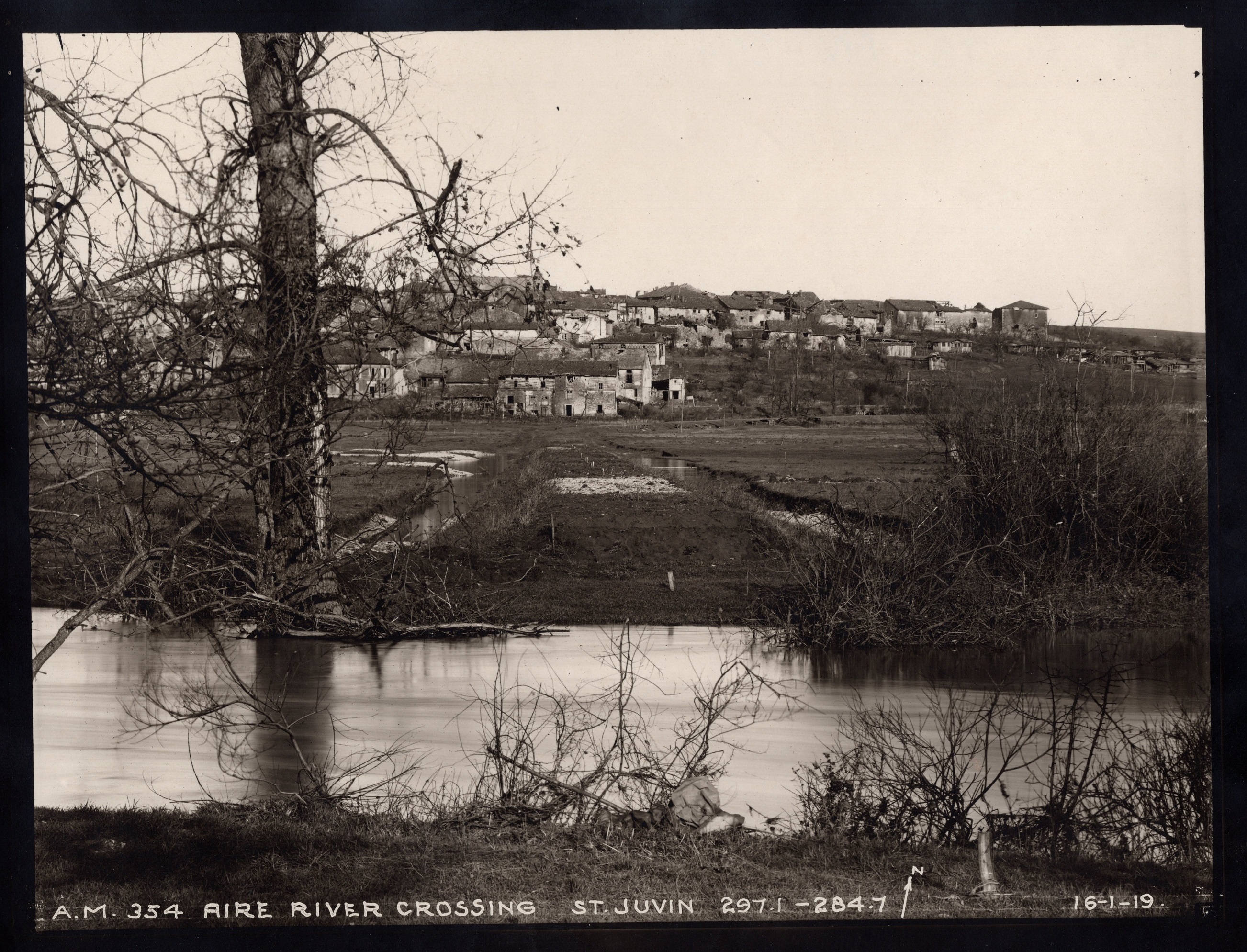
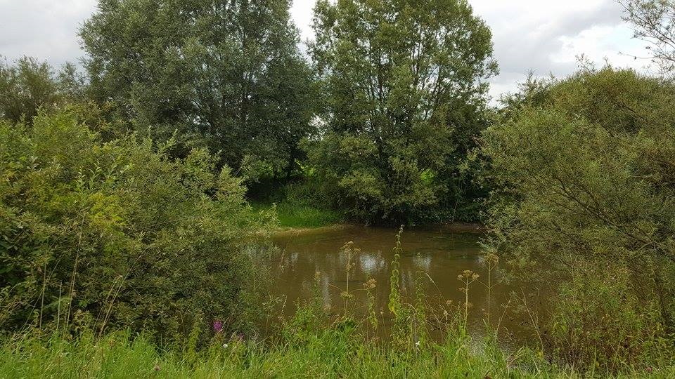
Caption: Griffin Group photo A.M. 354, “Aire River Crossing, St. Juvin, 297.1 – 284.7,” taken on 16 January, 1919. Again, the growth makes it difficult to have a great then and now comparison.
Location: East of the D42 at the Aire River, south of St. Juvin
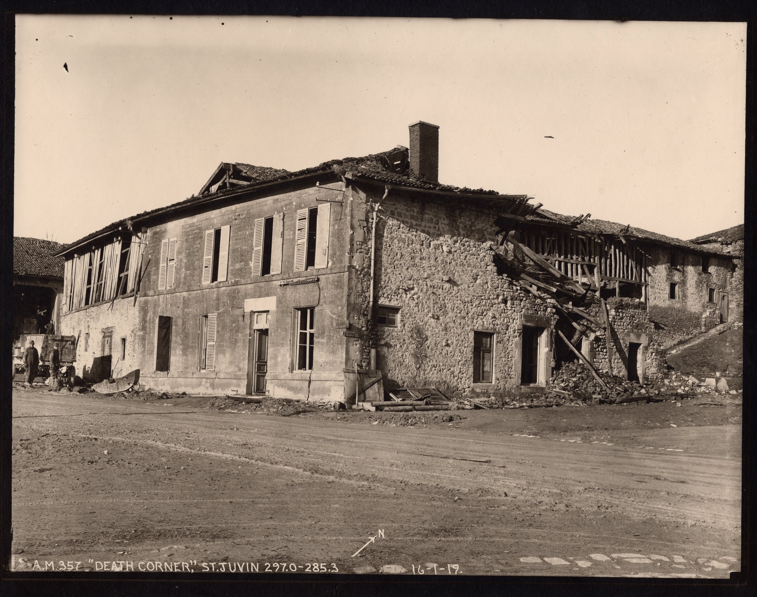
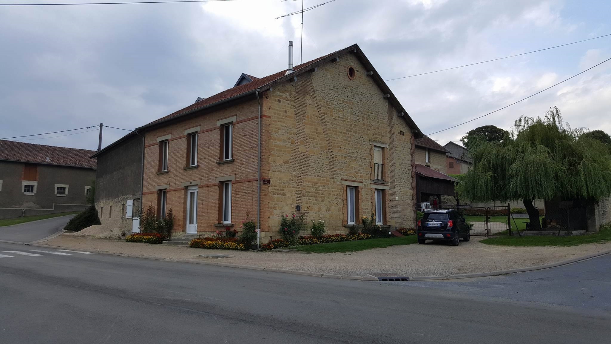
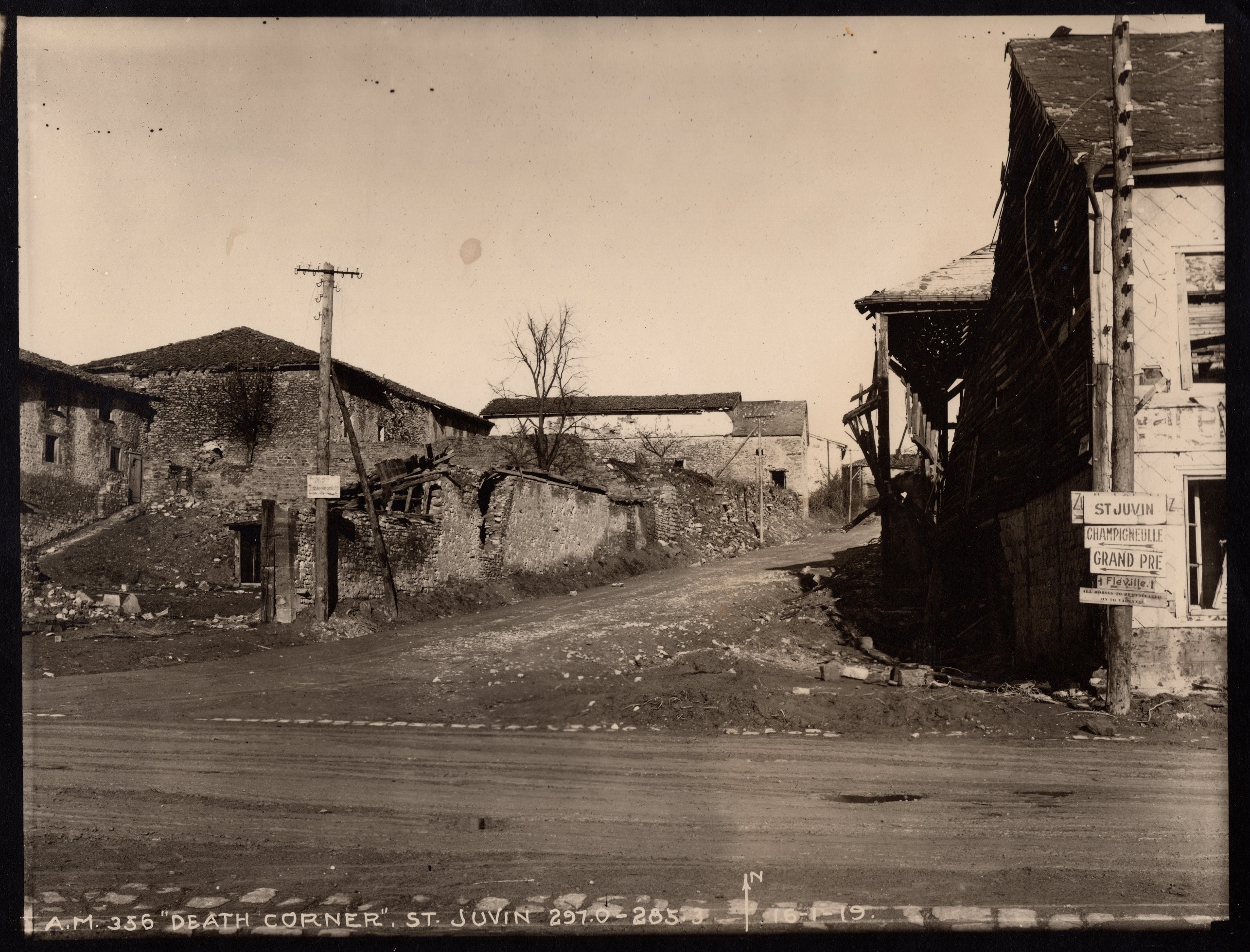
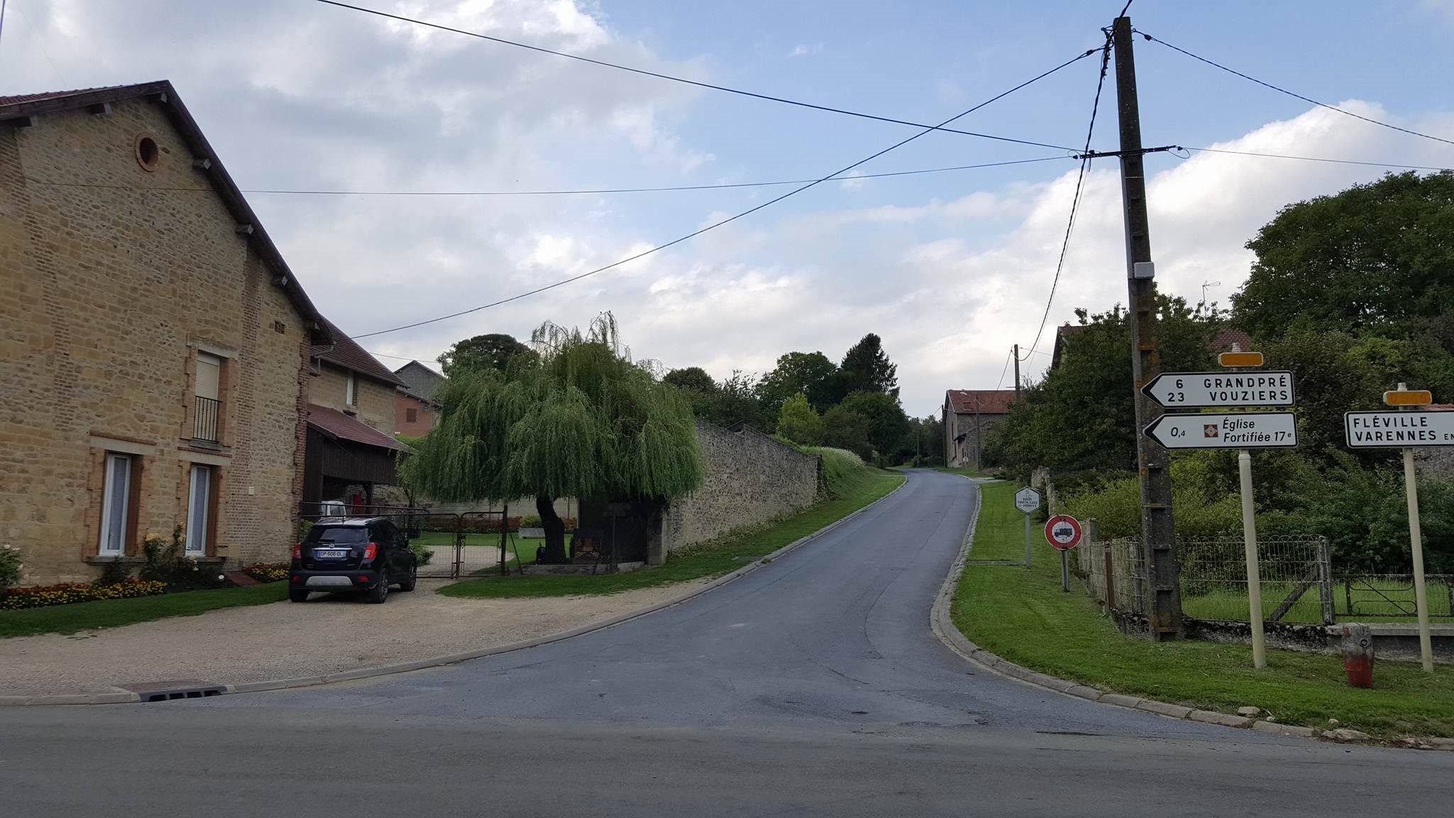
Caption: Griffin Group photos A.M. 356 and A.M. 357, “Death Corner, St. Juvin, 297.0 – 285.3,” taken on 16 January, 1919.
Location: At the intersection of the D42 and D946, in the southern portion of St. Juvin.
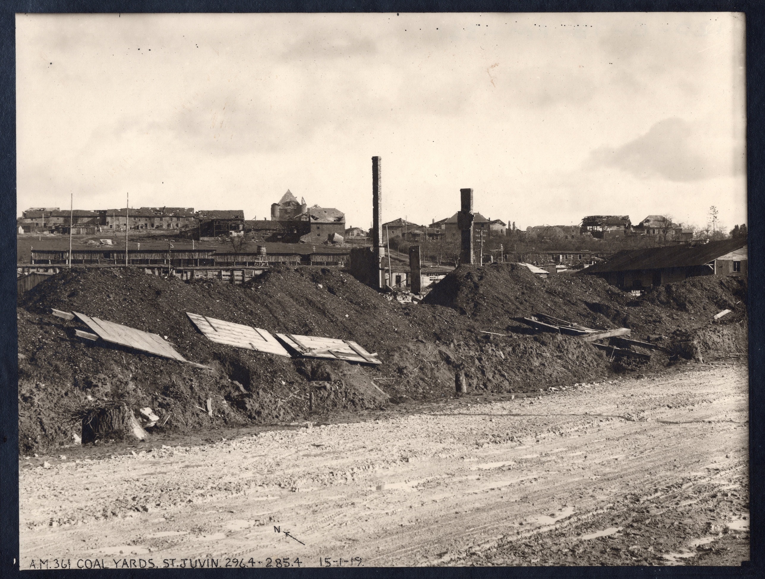
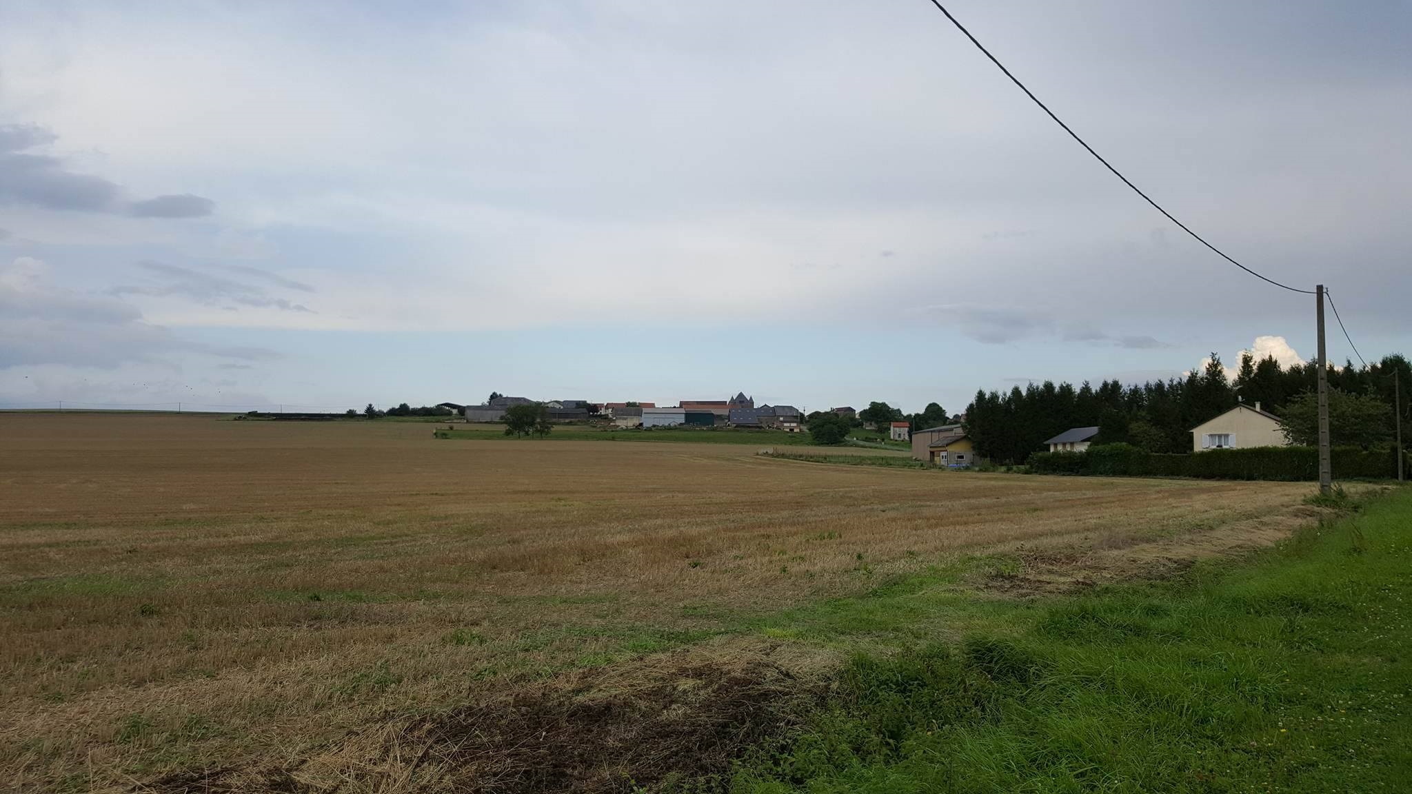
Caption: Griffin Group photo A.M. 361, “Coal Yards, St. Juvin, 296.4 – 285.4,” taken on 15 January, 1919. Unfortunately, there is nothing left to show the remains of the German coal yards. The road in the middle of the photo is the D55 running from the D946 northeast into St. Juvin; and that and the church provide the best way to match up the location.
Location: Along the D946, west of St. Juvin.
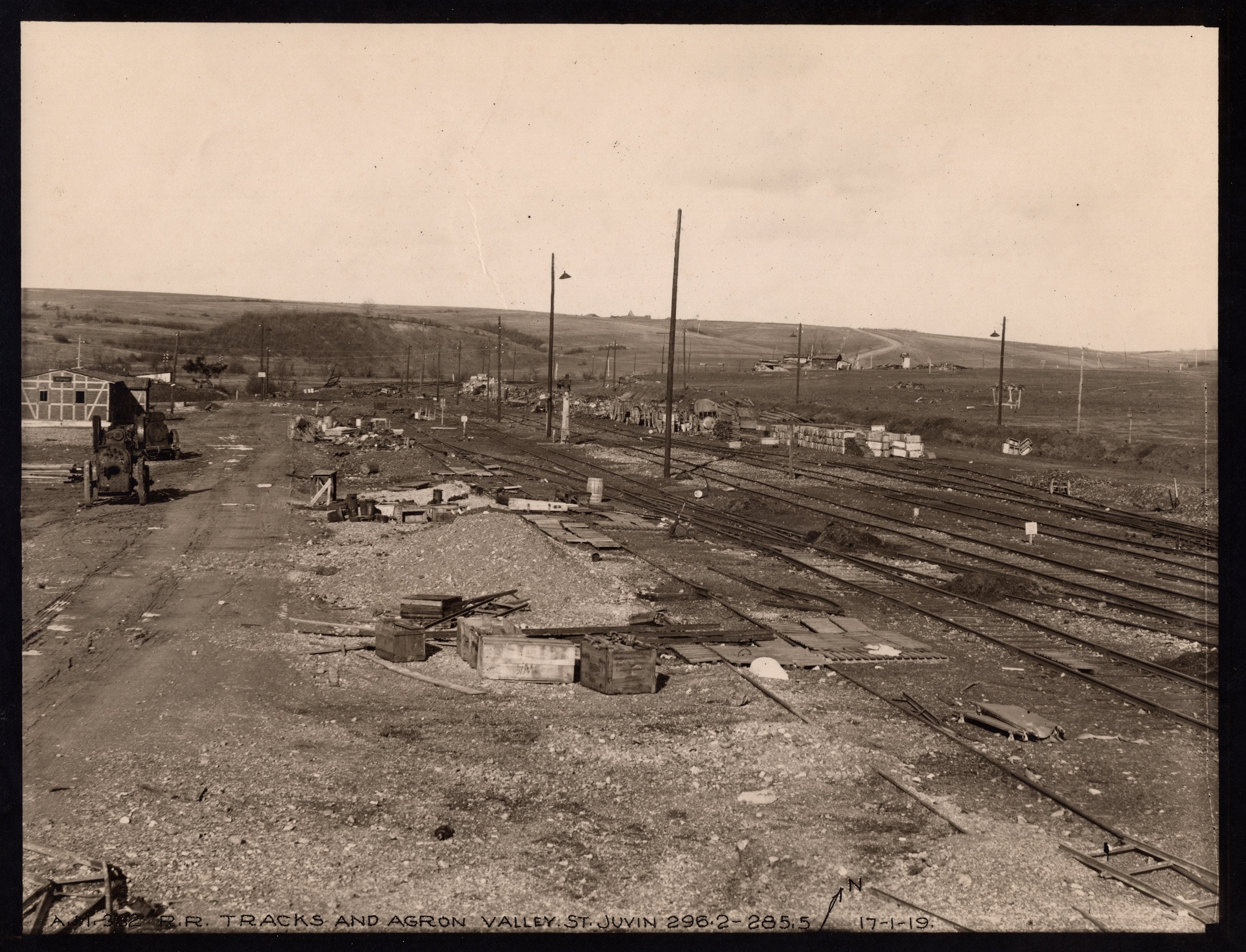
Caption: Griffin Group photo A.M. ???, “R.R. Tracks and Agron Valley, St. Juvin, 296.2 – 285.5,” taken on 17 January, 1919. Again, there is no trace of the railyard in today’s photo. The best line-up are the hill lines on the horizon and, of course, the level ground.
Location: On the D946, west of St. Juvin.
Source of Then Photos above: National Archives, Griffin Group Photos, Record Group 120G
Source of Now Photos above: Graham Gaulke
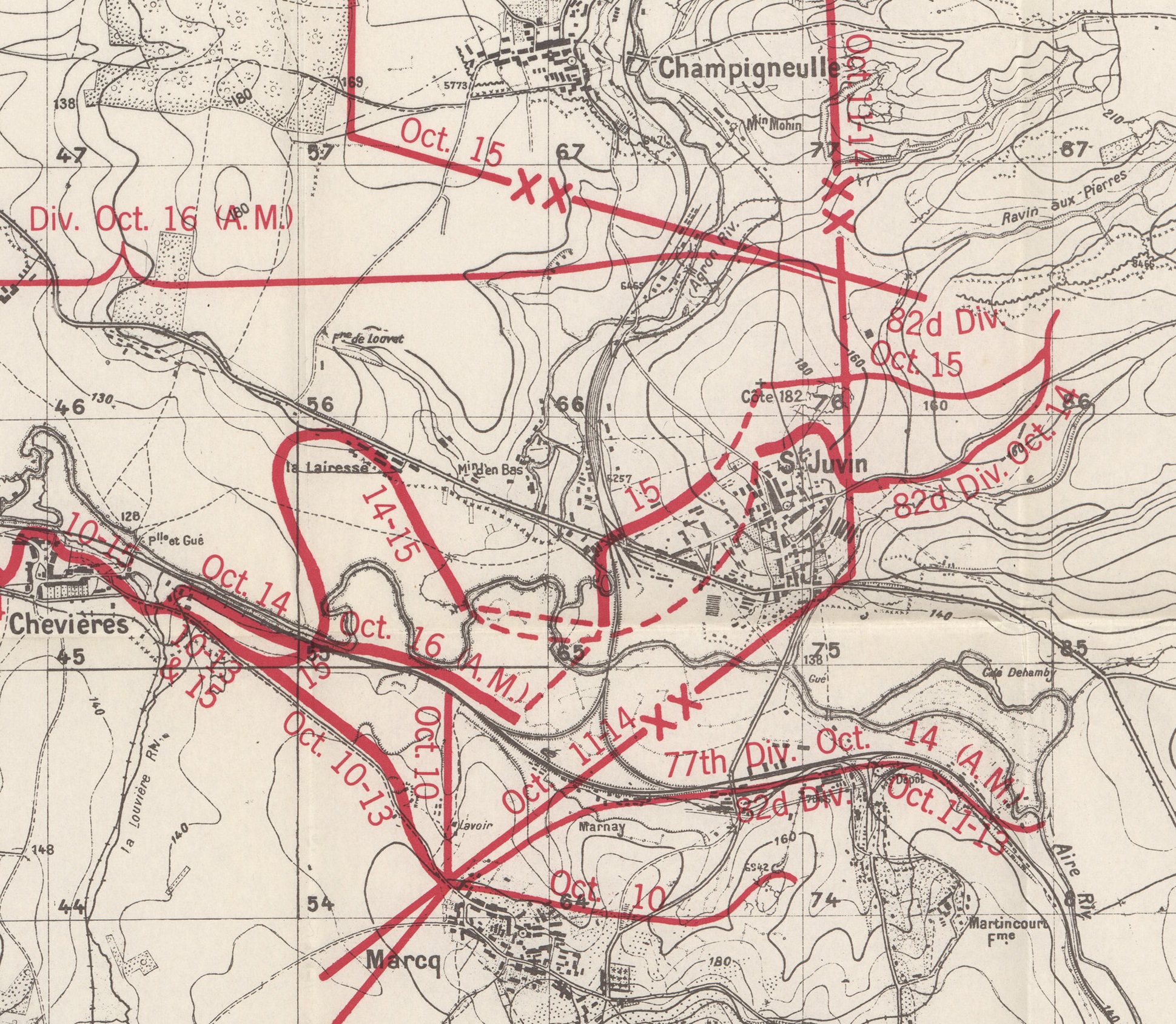
Excerpt of Map from “77th Division, Summary of Operations,” published by the ABMC in 1944.

